


Columbus Ward 5, Cherokee County, Kansas
About
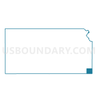
Outline

Summary
| Unique Area Identifier | 584207 |
| Name | Columbus Ward 5 |
| County | Cherokee County |
| State | Kansas |
| Area (square miles) | 0.72 |
| Land Area (square miles) | 0.72 |
| Water Area (square miles) | 0.00 |
| % of Land Area | 100.00 |
| % of Water Area | 0.00 |
| Latitude of the Internal Point | 37.16938940 |
| Longtitude of the Internal Point | -94.83356540 |
Maps


Graphs
Select a template below for downloading or customizing gragh for Columbus Ward 5, Cherokee County, Kansas


Neighbors
Neighoring Voting District (by Name) Neighboring Voting District on the Map
- Columbus Ward 1, Cherokee County, KS
- Columbus Ward 3, Cherokee County, KS
- Columbus Ward 4, Cherokee County, KS
- Crawford Township Voting District, Cherokee County, KS
- Salamanca Township Voting District, Cherokee County, KS
Top 10 Neighboring County Subdivision (by Population) Neighboring County Subdivision on the Map
- Columbus city, Cherokee County, KS (3,312)
- Crawford township, Cherokee County, KS (636)
- Salamanca township, Cherokee County, KS (505)